
A land asset management and data-as-a-service bundle that enables energy companies to identify and manage land assets using a combination of precise geospatial data, advanced software, and AI-enhanced data digitization services.
End-to-End Software for Land Acquisition, Management, and Mapping
Pandell Land & GIS Suite™
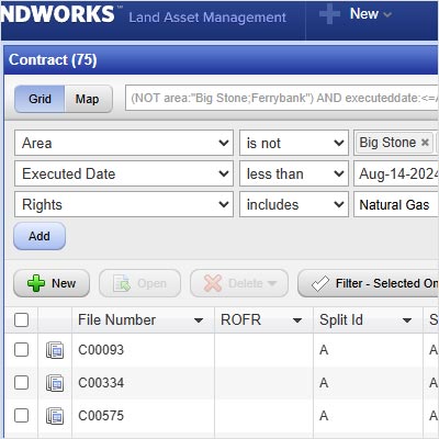
The software suite enables energy companies to centralize land acquisition projects, manage land assets, and generate reports; and is fully integrated with Esri’s ArcGIS technology.
Pandell Projects™ and Pandell LandWorks™ provide an advanced land acquisition and management solution for energy companies and land brokers, streamlining workflow and communication, and automating processes for efficient oversight of land assets throughout their life cycle.
Expert Digitization and GIS Mapping Services
AI-assisted Land Records
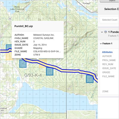
Digitize paper or PDF agreements into a land management system that provides a clear and accurate understanding of land holdings. This system enables quick searching, categorizing, and reporting on agreements. The Land Records team ensures data reliability across regions and land assets.
Paper-to-Polygon GIS Mapping
When in-house GIS expertise is lacking, other priorities need attention, or automated mapping fails, our team meticulously analyzes land data and legal descriptions to create polygons that represent the boundaries of agreements on a map.
Optimized with Whitestar Integrated Basemap & Precise Geospatial Data
TrueGRID™ Geodatabase
The robust, high-fidelity basemap, developed using authoritative survey plats from all the land survey types and layers in the U.S., provides companies with critical information to support better decisions.
Unified Data Experience
All datasets from Whitestar are accessible in one place, ensuring consistency and avoiding conversion errors.
Site Selection and Land Acquisition Tools
With Whitestar Energy Layer™, an extensive GIS database of spatial and attribute data for powerlines, pipelines, and facilities across all North American commodities, and Whitestar ParcelsHD+™, a national repository of normalized parcel data with up to 340 attributes for 3,143 counties; companies can make data-driven decisions on site selection and land acquisition, optimizing their investment strategies.
Automatic Mapping
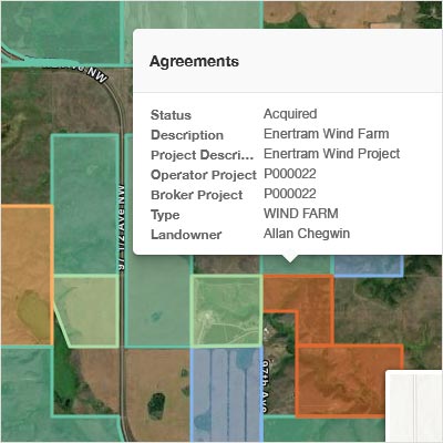
The integrated solution leverages Whitestar’s detailed and continuously updated land grid data for accurate and efficient mapping of land assets against the most reliable land grid in the industry. This reduces dependency on third-party corrections, and ties updates directly to the data source, ensuring faster adjustments and timely changes in land ownership, boundary adjustments, and legal descriptions.
Vertical Capabilities for Renewables-focused Tools
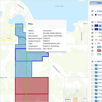
Integration of the Whitestar CultureHD™ layer with the Pandell Land and GIS platform offers hyper-contextualization and key insights for site selection and development, especially for renewable energy projects.
About Us | ESG
More than 800 energy companies worldwide rely on ESG solutions to grow revenue, increase efficiency, and facilitate business innovation. From project land-siting to retail billing, ESG solutions span the entire energy value chain. They include the Pandell land and finance platform, the Latitude pipeline platform, Whitestar geospatial data, land record digitization and GIS mapping services, and the ESG retail energy platform. ESG is SOC 2 certified in North America and ISO 9001/27001 certified in the United Kingdom. Through constant development of intelligent workflow solutions for oil and gas, pipelines, utilities, and renewable energy, ESG puts the power of data in your hands. For more information visit esgglobal.com.


